 Marinate
Nautical charts
OpenStreetMap + OpenSeaMap charts with buoys, lights, depths, and marinas — plus satellite, light, and minimal bases, depth shading, and offline downloads per area.
Explore charts →Marine navigation, done right
Marinate turns your phone into a full nautical chartplotter — live GPS on OpenSeaMap nautical charts, route planning, weather, tides, and AIS traffic. It works offline, with no account and no tracking.
On the App Store & Google Play · No account, no tracking · All your data stays on your device
Everything on deck
From the first waypoint to the trip logbook, Marinate covers navigation, planning, weather, and safety in a single chart-first app.
OpenStreetMap + OpenSeaMap charts with buoys, lights, depths, and marinas — plus satellite, light, and minimal bases, depth shading, and offline downloads per area.
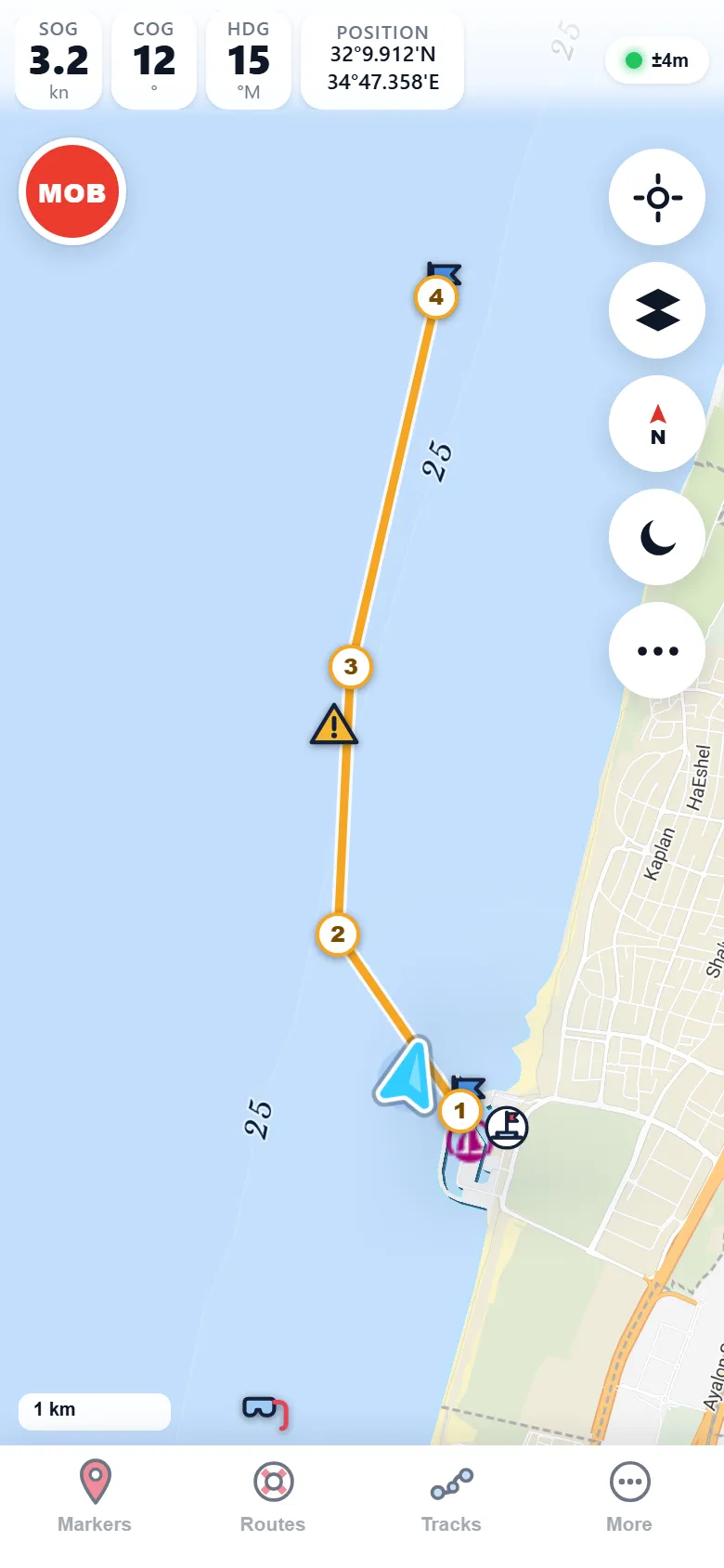
Explore charts →Plan multi-leg routes, navigate with live distance, bearing, ETA, and cross-track error, then record tracks and review every trip in the logbook.
Plan a route →Tap anywhere on the chart for wind, gusts, waves, and temperature, watch the animated wind-field forecast, and check tides and currents before you go.
Check the forecast →One-tap man-overboard with auto-return navigation and an anchor drag alarm on every boat — plus AIS collision warnings when you go Premium.
See safety tools →Big-number SOG, COG, heading, and position readouts, AIS vessel traffic, and live depth, wind, and speed from your boat via SignalK / NMEA.
Connect your boat →Built for iPhone and Android — with offline chart downloads, GPX import and export, and easy spot sharing.
Get the app →On the water
Clear at anchor, underway, and after sunset — with a red night palette that protects your night vision.


Screenshots from real passages — the app itself runs in English, French, Spanish, and Hebrew.
Our pledge
Some things should not sit behind a subscription. One-tap MOB and the anchor alarm are free for everyone, forever — no trial, no tier, no exceptions.

Simple pricing
Core navigation, MOB, and the anchor alarm are free forever. Premium adds advanced layers — with a 14-day free trial.
$0 forever
$14.99/year
$39.99 once
Prefer monthly? Premium is also available at $1.99/mo — compare all plans.
Cast off
Install Marinate from the App Store or Google Play, download your cruising area, and head out. No account, no tracking — just you, your boat, and the chart.