 Marinate
Instruments & Analytics
Numbers you can read from the helm
Marinate turns your phone or tablet into a glass instrument panel: live speed, course, heading and position, straight from GPS. Every passage you record rolls up into a trip logbook — and with Premium, you can replay it on the chart.
Free core forever. No account, no tracking — your instrument data stays on your device.
Live from GPS
SOG, COG, heading and position — big, steady, glanceable
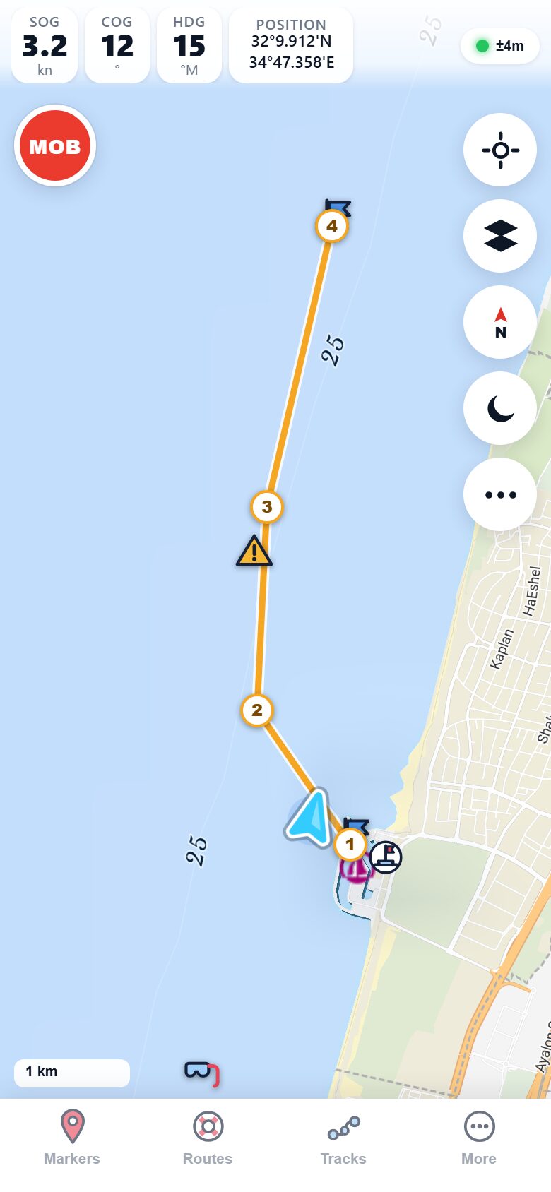
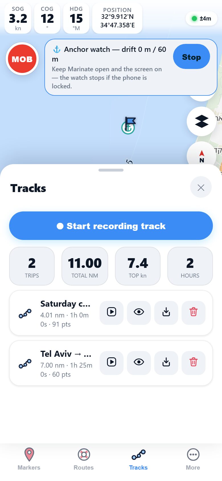
The instrument strip rides on top of the chart, driven by your device's GPS. Speed over ground, course over ground and heading update live while your boat marker tracks across the chart with its heading line and projected course vector.
Position reads in marine degrees and decimal minutes — the same format as your paper chart and your VHF position report — so you can pass a fix over the radio without converting anything.
- SOG & COG — speed and course over ground, updated as you move.
- HDG — heading shown on the boat marker and in the strip.
- Position in DMM — degrees, decimal minutes, chart-and-radio ready.
- Projected course vector — see where you'll be, not just where you are.
Boat network
PremiumSignalK & NMEA: your boat's own senses, on your screen
If your boat has a SignalK server or an NMEA gateway on its WiFi, Marinate reads it directly: depth under the transducer, apparent wind, boat speed through the water and heading from the compass — live, next to the chart.
The connection is local. Your phone talks to the gateway over the boat's WiFi, so instruments keep flowing with zero internet, miles offshore — the same offline-first rule as the rest of the app.
- Depth, wind, speed, heading from SignalK or NMEA sources.
- Works offline — data never leaves the boat's WiFi.
- Lives beside the chart, not in a separate app.
Bearing & range
Range rings, EBL and VRM — proper plotter tools
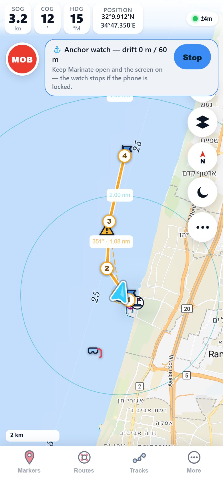
Switch on range rings and distance becomes visual: concentric rings around your boat tell you at a glance how far off that headland, mooring field or approaching vessel really is.
For a quick check on anything specific, the EBL/VRM readout draws a bearing line from your boat to the chart crosshair. Pan the chart so the crosshair sits on a landmark, a buoy or an approaching vessel, and read its live bearing and range from your boat — the classic radar answer, on your chart, free.
- Range rings centred on your live position, scaled to your zoom.
- EBL — a live bearing line from your boat to the chart crosshair.
- VRM — the same readout gives the range, for precise distance checks.
Tracks
Record every passage. Replay the good ones.
Tap record and Marinate lays your track down on the chart as you sail — every position, every speed change, kept on your device. Recording is free, always.
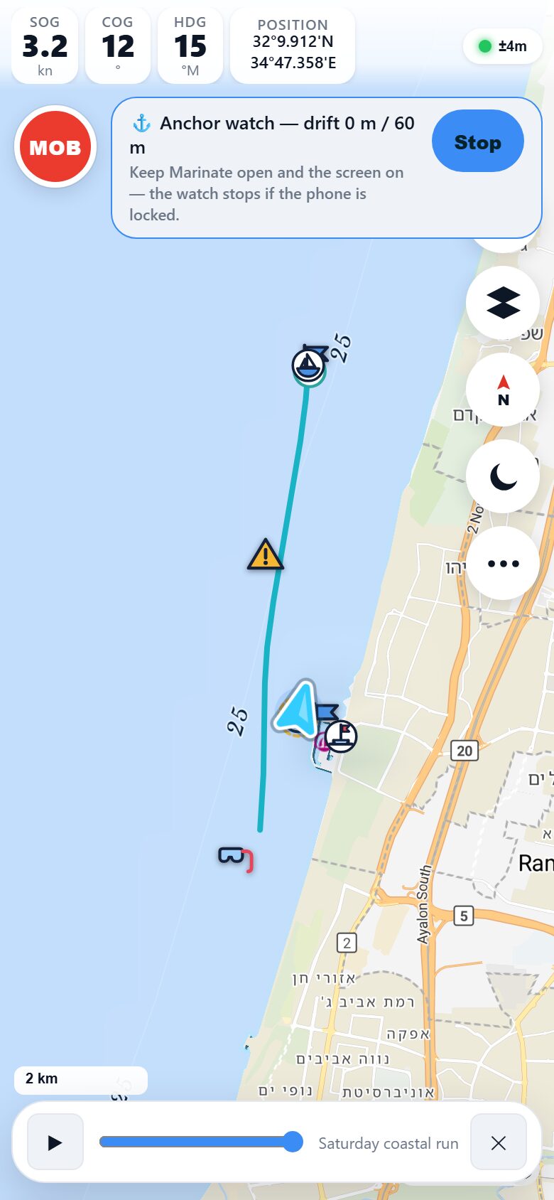
With Premium, track replay plays a passage back on the chart: scrub the timeline and watch your boat retrace the day — where you tacked, where you slowed for traffic, the line you took into the anchorage. It's how you debrief a race leg or show the crew exactly where the fish were biting.
- Track recording — free, on-device, works fully offline.
- Track replay Premium — scrub back through any passage on the chart.
- GPX export — your tracks are yours; take them anywhere.
Trip logbook
Your season, in numbers
Every recorded track rolls up into the trip logbook automatically: trips sailed, distance covered, top speed and hours under way. No forms to fill in after a long day — the log writes itself while you sail, and it all stays on your device.
- Trips
- 24
- Distance
- 412 nm
- Top speed
- 9.8 kn
- Under way
- 86 h
After dark
Instruments that respect your night vision
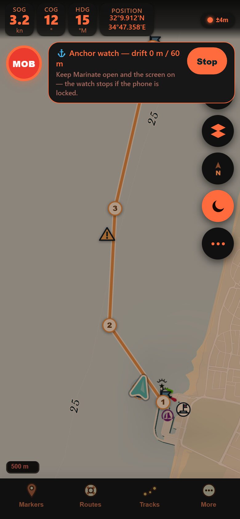
One tap switches Marinate into night mode: the chart dims and every instrument readout shifts to a warm, red-shifted palette that helps keep your eyes dark-adapted on the night watch. The numbers stay just as big and just as readable — without a white screen wrecking your view of the water.
- One tap — night mode toggles straight from the chart controls.
- The whole screen shifts — chart, instrument strip and buttons all dim together.
- Same big numbers — readouts keep their size and layout, day or night.
Free vs Premium
What's included where
| Feature | Free | Premium |
|---|---|---|
| Live GPS instruments (SOG / COG / HDG / DMM position) | ✓ | ✓ |
| Range rings, EBL & VRM | ✓ | ✓ |
| Track recording | ✓ | ✓ |
| Trip logbook analytics | ✓ | ✓ |
| SignalK / NMEA boat instruments | — | ✓ |
| Track replay | — | ✓ |
Premium includes everything in Free.
Questions
Instruments, answered
Do the instruments work without an internet connection?
Yes. GPS instruments come straight from your device's own receiver, and SignalK/NMEA data travels over the boat's local WiFi — neither needs the internet. Marinate is offline-first throughout: with charts downloaded for your area, the whole app keeps working miles offshore.
What do I need on board for depth, wind and speed?
A SignalK server or an NMEA gateway on your boat's WiFi network. Marinate connects to it and shows depth, wind, boat speed and heading live beside the chart. SignalK/NMEA instruments are a Premium feature, with a 14-day free trial.
Is track recording really free?
Yes — recording tracks and the trip logbook are part of the free core, forever. Track replay, which plays a recorded passage back on the chart with a timeline scrubber, is Premium. Your tracks always export to GPX either way.
What format is the position readout?
Marine degrees and decimal minutes (DMM) to three decimal places, e.g. 32°50.700′N 34°56.400′E — a fix from the same passage shown above, in the format used on nautical charts and in VHF position reports, so you can read it straight over the radio.
Put real numbers at the helm
Live instruments, tracks and a self-writing logbook are free forever. Try SignalK instruments and track replay free for 14 days with Premium.