 Marinate
Help center
How can we help?
Setup walkthroughs, answers to common questions, and a direct line to a human. Search the answers, pick a topic, or jump straight to the guide you need.
Try “anchor alarm” or “offline”.
First voyage
Getting started
Marinate is a native app for iPhone and Android. From install to your first plotted course takes about five minutes — no account, no sign-up, nothing to configure before you can see the chart.
Five minutes to your first course
- 1. Install the app. Get Marinate from the App Store or Google Play — see the Download page. The core app is free forever and works without an account.
- 2. Allow location access. On first launch, grant the location permission so the live boat marker can show your position, heading, and projected course.
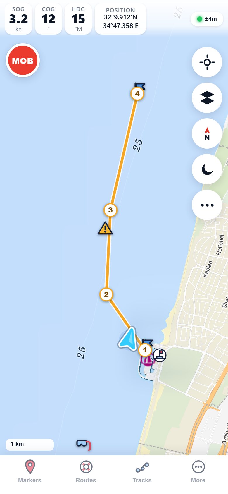
- 3. Explore the chart. Pan and zoom the OpenStreetMap + OpenSeaMap nautical chart — buoys, lights, depths, and marinas — and switch between satellite, light, and minimal base maps.
- 4. Download your cruising area. Before you leave the dock, open More → Download charts for current area to save offline charts, so navigation keeps working with no signal.
- 5. Drop markers and plan a route. Tap and hold to place a marker with photos and notes, or build a multi-leg route and start active Go-To navigation with distance to waypoint, bearing, and ETA.
Charts & offline
Charts and offline use
Where do Marinate's charts come from?
Marinate draws its nautical charts from community data: OpenStreetMap for the base map and OpenSeaMap for seamarks — buoys, lights, depth soundings, and marinas. Premium adds EMODnet depth shading and contours. These are community datasets, not official ENC charts, so always carry official charts and never rely on Marinate as your sole means of navigation.
How do I download charts for offline use?
Pan and zoom until your cruising area fills the screen, then open More → Download charts for current area. The charts for that area are stored on your phone and keep working with airplane mode on or far from shore. Premium unlocks unlimited offline areas, so you can keep every cruising ground you visit saved at once.
What works offline, and what needs a connection?
Everything core to navigating works offline once your area is downloaded: charts, GPS position, routes, markers, tracks, the anchor alarm, and MOB. Live data — weather, tides and currents, the animated wind forecast, and AIS vessel traffic — needs an internet connection, so check the forecast before you lose signal.
Can I change how the chart looks?
Yes. Switch between satellite, light, and minimal base maps, and use day/night mode for a red night palette that preserves your night vision. Range rings and EBL/VRM are there when you want quick bearings and distances straight off the chart.
AIS
AIS setup with aisstream.io
Marinate shows live AIS vessel traffic using a free API key from aisstream.io. The walkthrough takes a couple of minutes.
- 1. Create an aisstream.io account. Visit aisstream.io on your phone, tap "Login / Sign up", and register with an email — free, no payment details.
- 2. Generate an API key. After signing in, open "API Keys", tap "Create new API Key", give it a name, and copy the key.
- 3. Paste the key into Marinate. In the app, open More → AIS vessel traffic, paste your key, and turn on "Show live vessels & collision alarm".
- 4. Watch traffic appear. Nearby vessels show as heading-rotated arrows on the chart, and Marinate computes CPA and TCPA for each target — a vessel on a risky course turns amber, then red with an audible collision alarm. You can tune the CPA distance and TCPA time limits in the same screen.

Is AIS free in Marinate?
The AIS live-traffic overlay is a Premium feature — you can try it with the 14-day free trial. Whenever AIS is active, the CPA/TCPA collision alarm works and is never charged for separately on top of the layer. The anchor alarm and one-tap MOB are free for everyone, forever, on every plan.
Why don't I see any AIS targets?
AIS traffic streams over the internet, so you need a data connection. Check that your aisstream.io key is entered correctly under More → AIS vessel traffic, that your phone is online, and that there are transmitting vessels nearby — quiet anchorages can genuinely have no targets.
Boat instruments
SignalK / NMEA setup
If your boat runs a SignalK server bridging your NMEA instruments, Marinate can show live depth, wind, speed, and heading — and warn you with the shallow-water alarm.
How do I connect Marinate to my boat's instruments?
Join your phone to the boat's Wi-Fi — the same network your
SignalK server or NMEA gateway is on. Then open
More → Boat instruments and enter
your SignalK server's address, for example
192.168.1.50:3000. Once connected,
depth, wind, speed, and heading from your NMEA instruments
appear live in the app — entirely on the boat's local network,
no internet needed.
What is the shallow-water alarm?
When Marinate receives live depth from your boat's sounder via SignalK, you can set a minimum depth. If the reported depth drops below it, the app raises an alarm so you can react before you touch bottom.

Your data
GPX import, export, and sharing
Can I import routes and waypoints from another app?
Yes. Marinate imports standard GPX files, so routes, tracks, and waypoints from other chartplotters or planning tools come straight in. Open a GPX file on your phone and share it to Marinate, or import it from within the app.
How do I export or back up my data?
Routes, tracks, and markers export as GPX files you can save anywhere or open in other software. Because all your data lives on your device — Marinate has no account and no cloud — exporting GPX is also the way to keep your own backup.
Billing
Subscriptions & restoring purchases
How do I cancel or manage my subscription?
Subscriptions are billed and managed by the App Store or Google Play, not by Marinate. To change or cancel, open your phone's subscription settings — Settings > Apple Account > Subscriptions on iPhone, or Google Play > Payments & subscriptions on Android. Cancelling keeps Premium until the end of the paid period.
I bought Premium — how do I restore it on a new phone?
Install Marinate on the new phone, make sure you're signed in to the same App Store or Google Play account you purchased with, then tap "Restore purchases" on the Premium screen. Your subscription or lifetime unlock comes back at no charge.
Does Marinate require an account?
No. There is no Marinate account, no sign-up, and no tracking — all your data stays on your device. Purchases are tied to your App Store or Google Play account, which is why restoring is done through the store.
Troubleshooting
When something's not right
My GPS position is missing or jumping around
Check that Marinate has location permission in your phone's settings and that location services are on. GPS works best with a clear view of the sky — position can wander below decks or in a marina surrounded by tall structures. Give the fix a minute to settle after launching the app.
The chart is blank or missing detail offshore
If you're out of signal and the area wasn't downloaded, the chart can't load new tiles. Reconnect, open More → Download charts for current area, and save the area — then it stays available. Chart detail also varies by region, since OpenSeaMap coverage depends on community contributions.
Weather or tides won't load
Weather (Open-Meteo) and tide data are fetched live, so they need an internet connection. If you're online and it still fails, try again shortly — and make it a habit to check the meteogram before leaving coverage.
The anchor alarm didn't sound
The watch only runs while Marinate is open on screen. It checks your position on every GPS fix, and locking the phone or switching to another app stops the fixes arriving. The app keeps the screen awake for you; leave it in the foreground, ideally on charge. If it does get backgrounded, the app tells you how long the watch was not running when you come back — it will not pretend to have been watching.
Otherwise: confirm the watch circle was set when you anchored and that the drag alarm is armed, turn off battery optimization for the app on Android, and make sure your phone's volume is up and it isn't in a do-not-disturb mode that silences alerts.
Background monitoring with the phone locked is on the roadmap. Until it ships, treat the anchor watch as a second pair of eyes while you are aboard and awake, not as an unattended alarm.
Track recording stopped in the background
Phone operating systems can suspend background apps to save power. Allow background location for Marinate and exclude it from battery optimization on Android. On long passages, keeping the phone on charge is good practice anyway.
How do I change the app language?
Marinate's interface is available in English, Hebrew, French, and Spanish. Pick your language in the app's settings, or let it follow your phone's system language.
A note on safety: Marinate uses community chart data and is an aid to situational awareness — never the sole means of navigation. If an alarm, chart, or reading ever seems wrong, trust your eyes, your official charts, and your seamanship first.
Contact
Still stuck? Talk to us.
If the guides above didn't solve it, email us and a human will help — we reply within 1–2 days, usually sooner. Include your phone model and what you were doing when the problem appeared; it makes the fix faster.
Questions about your data or the fine print? Read the Privacy Policy and Terms of Use.
Ready to get back on the water?
Marinate is free forever for core navigation, with MOB and the anchor alarm never paywalled — install it from the App Store or Google Play.